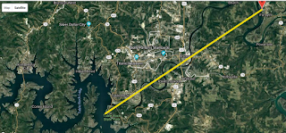
The photo was taken at my residence balcony located at Lat 36.69045541922207, Long -93.12413837409667. Elevation 241 meters. Time of photo ~7:05 PM, July 19, 2018. Below is the direction line of the location of the Ride the Ducks accident some 12 miles straight line distance.
Google map showing this line.
It's my thought that what the photo maybe showed indications of what was a micro-burst in progress which struck the boat that saw 17 individuals lose their lives.


No comments:
Post a Comment